
Search our website enhanced by Google.
Precision agriculture for soils
Soil electrical conductivity (EC) is a measure of the soil’s ability to conduct an electric current, and is used to identify differences in soil texture, moisture and organic matter content.
Soil EC scanners make contact with the soil and measure variation in electrical conductivity across the field.
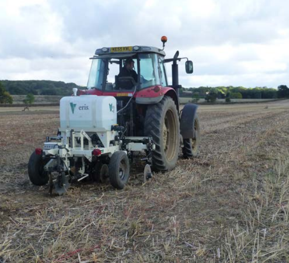
This method typically uses two or three pairs of coulters mounted on a toolbar. One pair provides an electric current into the soil (transmitting electrodes) and the other coulters (receiving electrodes) measure the voltage drop between them.
Soil electrical conductivity (EC) scanner
Non-contact electromagnetic induction (EMI) sensors are held above the soil when scanning.
This method uses the principle of electromagnetic induction to derive the apparent electrical conductivity of the soil.
These sensors have a transmitter and receiver coil at opposite ends of the unit, and a sensor in the device measures the resulting electromagnetic field that the current induces. The strength of this secondary electromagnetic field is proportional to the soil electrical conductivity.
Soil electromagnetic inductance (EMI) scanner
 scanner-1.png)
Although EC and EMI scanners use different methods for measuring soil electrical conductivity, research has shown that they provide comparable information on soil variability.
The main factors affecting soil electrical conductivity are texture, moisture and organic matter content and bulk density.
In the majority of fields, soil texture is the main cause of soil electrical conductivity variation.
Soil moisture content may affect the measured EC values but will not affect the pattern of variability – a soil EC map will consistently identify areas of different soil texture regardless of the soil moisture content at the time of measurement.
Studies have demonstrated that fields mapped several times during the year at differing soil moisture contents had different EC values but consistently identified the same pattern of variation in soil texture.
EC and EMI surveys are conducted when there is no crop cover (typically during the autumn/winter period between crops).
For ‘contact’ EC sensors, it is important to ensure good soil-to-coulter contact, so scans are usually carried out following harvest, prior to cultivations.
The instruments are pulled across the field by a tractor or truck at bout widths typically between 12–24 m.
The information is combined with GPS data to produce a soil EC map.
Soil EC measurements should not be taken when the soil is frozen.
Some EC and EMI scanners will measure conductivity for two depths simultaneously, providing EC maps for a shallow and deep vertical cross-section.
Growers should use the shallow EC measurements for directing soil sampling, and the deep EC measurements for comparing soil EC and crop yield maps or as a basis for variable-rate seeding, as crops are affected by soil properties to rooting depth.

Topics:
Sectors:
